Wednesday, March 19, 2014

Sandy River Rambles: Sandy to Gresham Via Orient Drive on a Stormy Winter Evening

Sandy River Rambles: Sandy to Gresham Via Orient Drive on a Stormy Winter Evening

or

Seeking Shelter From the Storm and Finding Healing in a Sunset


I lived in Portland more than 17 years before I discovered Orient Drive.  I normally drove home from Mt. Hood on the road most often traveled -- Highway 26 from Sandy to Gresham, Oregon.  The first time I traveled Orient Drive was on a stormy winter day.  The drive and the storm inspired me in multiple ways.  First, I found myself fascinated as I recognized bits of history along the road.  Second, when I looked at my photos after the drive, I immediately saw two metaphors for very important aspects of healing:  Keeping yourself safe in the storm and finding healing in a moment of beauty such as an awesome sunset.

In 1846 during the days of the Oregon Trail, there was no Sandy and no Gresham.  Perhaps a few scattered farmsteads occupied their place.  The main road from The Dalles to Portland, Oregon, other than the Columbia River, was the Barlow Trail.  It was not a road for the faint of heart.  In places it was barely a road at all.  The infamous Laurel Hill on the western side of Mt. Hood was a one way passage from east to west; west to east traverses of the hill being impossible in a wagon.  Pioneers removed the wheels from their wagons and guided them down the 6o degree slopes of Laurel Hill with ropes as they traveled east to west.

Even after the Oregon Trail days ended, the Barlow Trail remained the main east to west route.  When the Mt. Hood Highway was built in the 1920s, it followed the Barlow Trail in places.  In others it followed gentler passages.  Plans to turn the Mt. Hood Highway into a freeway were scuttled in the 1970s, but much of the road was realigned as the freeway was partially built.  Some portions of the old highway remain visible if you look for them.  When we drove on Orient Drive for the first time, we recognized development that seemed like Route 66 -- mid-century motels and restaurants.  I have not been able to find confirmation anywhere, but I suspect that Orient Drive is the remnants of the old Mt. Hood Highway between Sandy and Gresham.

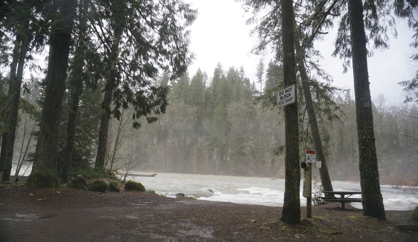
That first time on Orient Drive came on a winter day during a burst of driving rain.  The rain flowed so fiercely, almost as heavy as if someone was shooting a fire hose at the windshield, that I could not see. So I pulled off the road and sat out the drenching.  Now I am a cautious driver.  Others less daunted by the rain passed me by, but I would rather be safe than sorry as the old saying goes.  Then, as the rain flow tapered, the clouds parted and the sun peaked through, silhouetting in gold the now forested cinder cones of an ancient lava field.  The drenched pavement mirrored the golden glow.  As we drove on, the car headlights and tail lights and the traffic lights at intersections shimmered red and green and white on the wet macadam, and the road through exurbia became breathtaking.

As I looked through my photos after this breathtaking, rain soaked drive, two aspects of healing became obvious.

First, when we are stressed whether by interpersonal conflict or by other difficult events in our lives, we can lessen our stress by taking breaks that remove us from the heat of the moment.  

If you are arguing with someone you can simply say, "I need a break right now;  I can't talk about this right now.  After a break we can resume discussing this issue."

For your own healing and development, you should keep your commitment to resume the discussion as complete avoidance of difficult issues tends to worsen them.  However, healing yourself so you can respond from your heart instead of reacting from your gut usually improves the situation.  After working on healing yourself and working out a better approach to a difficult topic, go back to the discussion.

There are many ways to heal one's self, but exposing one's self to beauty is an easy way to automatically calm the mind.  I like to walk through my garden filled neighborhood to heal and uplift myself.  Evening walks around sunset reinforce the healing beauty off the gardens and charming older bungalows.  Driving through the sunset, as you can see in the following blog, works too.

We can't schedule drenching rainstorms when we need them, but I am sharing my experience with you.  So enjoy.


On a rainy winter evening, the wind blasts from the west, and the sky opens up and pours, obscuring the road.
We pull off and wait rather than risking the driving rain.


Others, braver or perhaps more reckless than we,
pass us by,


kicking up the storm water around them.


Before the flood ceases, the sun peeks through a seam in the rain blurred sky.


The downpour pauses,


but scattered drops still sprinkle the pavement and camera.


We drive onward, consumed with awe.  
Sunset and streetlights reflecting on the wet macadam,


creating a color filled tableau in the fading light of the day: bright red, streetlight green, and lush grass green.


Roiling blue grey clouds, highlighted in gold and peach and pink silhouette the tree lined bluff beyond the boulevard.


Even after the downpour passes, and the soaked landscape glistens brilliantly in the last blazing rays of day.


We head home, mesmerized by the fey vision of the storm drenched fray.


Reflections:

Do you ever feel as though life has rained down upon you so forcefully that you cannot move forward?

In what ways is your life stormy?

How long does the downpour last?

What kinds of things can you do to seek shelter from these storms?

What kinds of beauty in your life have you experienced after a downpour?

What can you do to help yourself to heal yourself after an emotional storm?

Directions:
Driving west towards Gresham turn right off Highway 26 onto SE Orient Drive just after Sandy, Oregon.
Follow SE Orient Drive to SE Powell Valley Road.  Turn left onto SE Powell Valley Road to Highway 26. 
Follow Highway 26 to I-205.
or
Follow SE Orient Drive until it becomes SE Kane Drive.
Follow SE Kane Drive until it becomes NE Kane Drive.
Follow NE Kane Drive until it becomes SW 257th Avenue.
SW 257th Avenue becomes Graham Road.
From Graham Road you can merge with I-84.

References:
Oregon Encyclopedia: Barlow Trail (http://www.oregonencyclopedia.org/entry/view/barlow_road/)
Wikipedia: Marmot, Oregon (http://en.wikipedia.org/wiki/Marmot,_Oregon)

© 2014 Virginia Pickles Jones


Tuesday, March 18, 2014

Sandy River Rambles: Wandering Dodge Park on a Rainy Winter Day

Sandy River Rambles: Wandering Dodge Park on a Rainy Winter Day

or

 Acceptance of Every Person, Place, and Time

On winter afternoons when you don't have time to wander far from Portland, Oregon, drive through farms and forests along the Sandy River from where The Old Columbia River Highway departs from Interstate 84 to Highway 26 by Sandy, Oregon.  Dodge Park, midway between the two points offers the opportunity to get out and walk around, picnic at a table, or visit the restroom.  The park also provides both the spiritual uplift found in nature as well as metaphors for as aspects of healing, such as accepting ourselves and others and the consistency of change.  Dodge Park has changed much over the passing years and has meant different things to different people at different times.

Two centuries ago, explorers Lewis and Clark named the Sandy River -- the Quicksand River -- due to the large amount of ash from an eruption of Mt. Hood in the late 18th century.  The ash clogged the Sandy River where it flowed into the Columbia River but has since mostly eroded away.  Like the rest of the Oregon, the area was wilderness inhabited by only Native Americans.  A century later the Mt. Hood Railway and Power Company ran a train from Portland, Oregon, to a park at the confluence of the Sandy and Bull Run Rivers.  The park was named the Bull Run. The train transported more than 30,000 visitors to the park every year.  You could embark the train at Montavilla Station on the east  side of Portland in the morning, disembark at the park an hour and a half later, and return home on the evening train.  Many visitors came on hot summer days to sit or swim or picnic by the river.  

Many things have changed at Bull Run Park over the years, including the name.  The park was renamed for a former Superintendent for the Portland Water Bureau -- Frank Dodge.

The road which now serves the area was built in the 1920s.  Rail service ended in 1930.  Since then the train tracks and trestles have been torn up so completely you cannot tell where they once ran.

Today if you drive to Dodge Park from Troutdale on Lusted Road, you cross the river on this bridge.  


This bridge, too, has seen many changes.  Before being moved to the Sandy River, it served as a span of the Burnside Bridge over the Willamette River in downtown Portland.


Driving into the park you come upon an old stone building, the Community Hall, a rare reminder of the glory days when tens of thousands of people visited Dodge Park each year.


The now sparse park once held 168 picnic tables and 72 campfire grills.  Now just a scattered few survive.


Walk through the park where so many others once tread.


Memories of past picnics, family reunions, and weddings steep the stone walls of the Community Hall.


But today, under oozing skies, we find no picnicking people, no weddings, no swimmers…
just ferns…


….and roots eroded from years of rushing ….


……winter waters,


….and a rain swollen river ripping around rocks and forging whitecaps.


Mist nestles in the forest on the bluffs above the channel…


….and wanders down stream.


Lush seasons of wet weather sustain the moss on this boulder by the bank…


 …and the fungus creeping across the nearby tree stump…


Lichens and mosses, awakened from their summer dry season sleep by the winter rain, animate life in brilliant chartreuse green, hospital green, olive drab green, and pale beryl green,


creating a tangle of textures and colors on the trunks and branches of trees throughout the park.


On this tree trunk moss fronds lunge skyward, like tiny banshees, screaming out for any ray of light straying from the rain clouds.


On this day the rain bloated river gobbles the beach where so many seasons ago hundreds refreshed themselves in the placid summer stream.


On another winter day -- one without rain --  calm waters expose the beach,


Bringing fishermen…


….to the river shore. 


Every few yards they stand, hauling rods, lines in the river, trolling for Steelhead.

Every winter day is its own season: Stormy and wet one day, cloudy and cold another, then sunny and mild a third.

Every season brings change: Winter steelhead fishermen are replaced by spring wildflowers which are  replaced by summertime campers who are replaced by a lonely visitor with camera on a wet winter day.

Every generation brings change: Wilderness is replaced by train trestles and thousands of summer pilgrims which are replaced by a macadam road and a dozen winter steelhead fishermen.

Only one thing remains the same through the millennia -- the Sandy River courses through foothills and forests, by field and farm from Mt. Hood to the mighty Columbia.  But over eons of time, this too will change.

Reflections for healing:

What would you prefer to experience: The crowded summer beach of long ago with thousands of fellow visitors or the solitude of a stormy winter day or the winter fishing season with fishermen every few yards along the river?

Would other people choose differently from you?  Why or why not?

Is any season or time more perfect than another or do we each have our own season and time?

Can you accept that others are not like you and have their own needs and desires and feelings?

Is there any value judgement to different needs, feelings, and desires?  Is it better to be the beach bather of 100 years ago or the steelhead fisherman on a mild winter afternoon or the lone visitor with a camera on a stormy day?

Each person, place, time, and experience has its own value and beauty.

Is there more than one way to cross a river?  In what ways have people crossed the Sandy River at Dodge Park?

Is there one way only to solve a problem or is there more than one way?

What are some of the changes experienced by the Sandy River at Dodge Park?

Do things stay the same or do they change?  How do they change?

Interesting websites with historical information and photos of Dodge Park 100 years ago (not linked at this time):
PdxHistory.com
Portland Water Bureau:  Dodge Park History
Wikipedia


Directions to Dodge Park from Highway 84:  
Take 84 to the exit for the Old Columbia River Highway.
Turn left and cross the Sandy River at the second bridge south of 84 -- the Stark Street Bridge -- onto SE Stark Street.
Take the extreme left turn before the top of the bluff onto SE Kerstake Road.
Turn Right onto SE 302nd Avenue.
Turn Left onto SE Division Drive.
Turn Right onto SE Oxbow Drive.
Keep left on SE Oxbow Drive.
Turn Right onto SE Hosner Road.
Turn Left onto SE Lusted Road.
Stay on Lusted Road as it descends the bluff towards the Sandy River.
Cross the Bridge.
Dodge Park is to your left.

Directions to Dodge Park from Sandy, Oregon, on Highway 26:
Heading towards Mt. Hood, just after the couplet through Sandy reunites, turn left onto SE Ten Eyck Road.
Conversely, if you are heading west on Highway 26 going from Mt. Hood towards Portland, turn right onto SE Ten Eyck Road before reaching the couplet.
Follow the signs for SE Ten Eyck Road until you reach SE Lusted Road.
Turn Right on SE Lusted Road and follow signs for the road until you reach Dodge Park on the right.  If you cross the bridge, you have gone too far.